Hurricane Erin’s Potential Impact on Ocean City, Maryland Beaches
As Tropical Storm Erin strengthens in the Atlantic Ocean, Ocean City, Maryland, a popular coastal destination, is bracing for potential impacts on its beaches. Forecast to become a major hurricane by the weekend of August 16, 2025, Erin is expected to remain offshore but could still significantly affect the region’s coastline, particularly through dangerous rip currents, increased wave activity, and possible beach erosion. Here’s a detailed look at what Ocean City residents and visitors can expect, based on the latest forecasts and local preparations.
Erin’s Forecasted Path and Strength
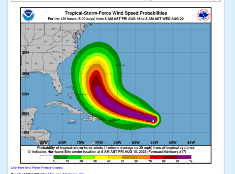
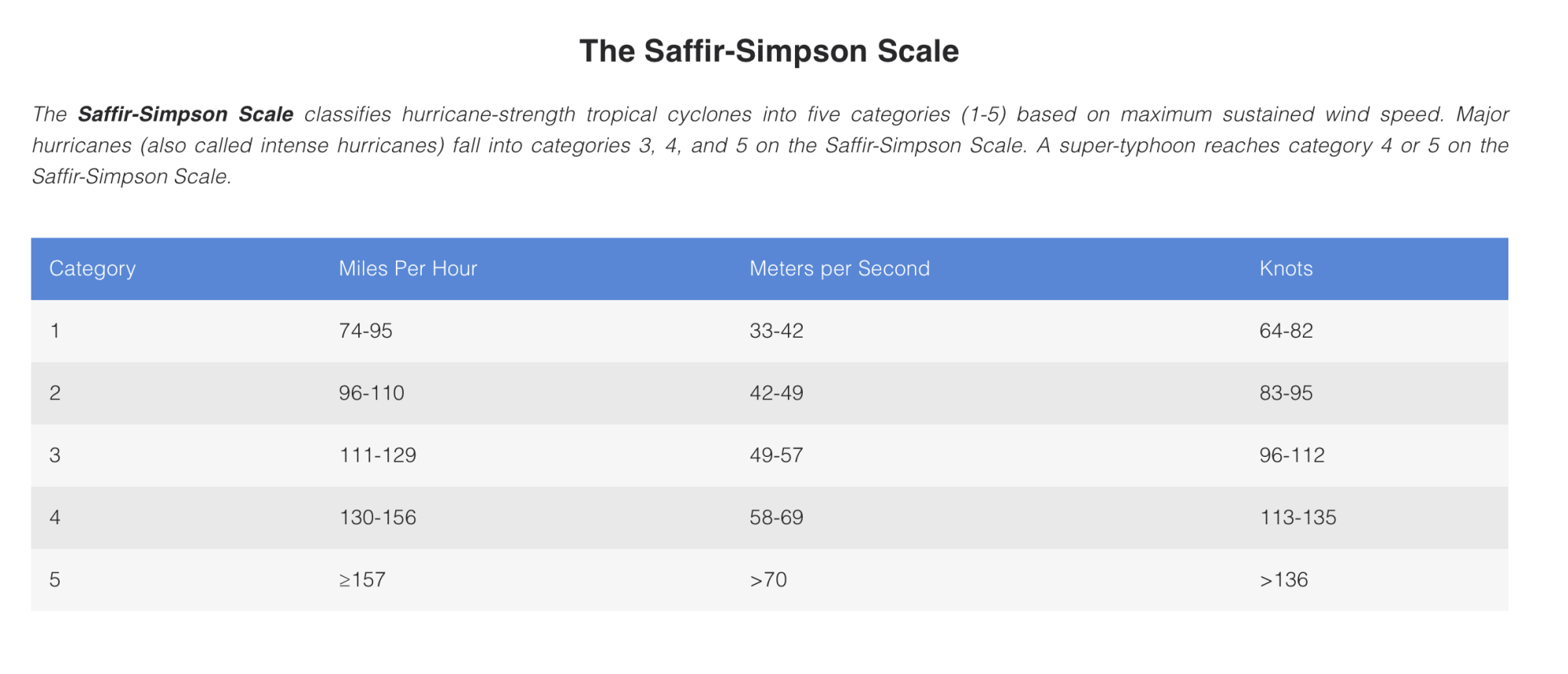
Tropical Storm Erin formed on August 11, 2025, over 2,500 miles from Baltimore in the eastern Atlantic. Meteorologists from the National Hurricane Center (NHC) and AccuWeather predict Erin will intensify into a Category 3 hurricane, with winds exceeding 111 mph, by Saturday, August 16, as it passes north of the Leeward Islands. While the most likely track keeps Erin hundreds of miles offshore from the U.S. East Coast, its large wind field and rapid strengthening could churn up the Atlantic, sending significant swells toward Ocean City by the weekend and into the following week.
Dangerous Rip Currents
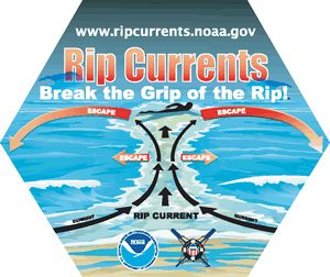
The primary concern for Ocean City’s beaches is an elevated risk of rip currents, which are expected to intensify from Saturday, August 16, through Friday, August 22. The Ocean City Beach Patrol has issued warnings about these fast-moving channels of water that can pull swimmers away from shore. Captain Butch Arbin noted, “It’s supposed to be a beautiful day down here, but if we get some wave action, that’s the formula for strong rip currents. People look at the ocean, and it looks inviting, but they don’t really know how dangerous it is.”
Rip currents are particularly hazardous near jetties and piers, common features along Ocean City’s 10-mile coastline. The National Oceanic and Atmospheric Administration (NOAA) advises swimmers to watch for flat spots in breaking waves, foam or sediment moving offshore, or darker water areas, which may indicate a rip current. With waves potentially reaching 5 feet or higher between Wednesday and Friday, August 20–22, the risk of deadly rip currents will peak, prompting local officials to urge swimmers to stay near lifeguards and heed posted warnings.

Rough Surf and Beach Erosion
Erin’s size and strength are likely to generate large swells across the Atlantic, leading to rough surf along Ocean City’s beaches. Forecasters predict wave heights could exceed 5 feet, particularly midweek, causing choppy conditions that make swimming hazardous even for experienced swimmers. These swells may also contribute to beach erosion, a recurring issue for Ocean City, as seen during past storms like Hurricane Ian in 2022, when sand was pushed onto the boardwalk.
The town’s history with hurricanes, such as Hurricane Isabel in 2003, shows that even storms remaining offshore can erode beaches and damage coastal infrastructure. Ocean City’s Emergency Management team is monitoring conditions closely, working with the National Weather Service to assess whether protective measures, like reinforcing dunes or restricting beach access, will be needed.
Breezy Conditions and Higher Tides
While Erin is not expected to make landfall, breezy winds with gusts up to 40–60 mph are possible along Ocean City’s coast, especially if the storm tracks closer to the U.S. than anticipated. These winds, combined with a full moon on August 9, could lead to higher-than-normal tides, increasing the risk of minor coastal flooding during high tide cycles. Gale-force winds are more likely offshore, potentially affecting marine activities like fishing, a key draw during events such as the White Marlin Open.
Safety Measures and Local Preparations
Ocean City’s Emergency Management Office emphasizes preparedness during the hurricane season, which runs from June to November. The town may issue swimming restrictions, limiting beachgoers to knee- or waist-deep water to reduce the risk of rip current incidents. If conditions worsen, lifeguards may prohibit swimming entirely when they are off-duty. Visitors are urged to swim only at lifeguarded beaches, know their location for 911 calls, and avoid entering the water alone.
For those caught in a rip current, experts recommend staying calm, swimming parallel to the shore to escape the current, and signaling for help by waving arms or shouting. Captain Arbin advises, “R – relax, don’t panic. I – I need help. P – parallel, swim parallel to the beach.” Non-swimmers and those with limited swimming ability should avoid the water entirely during this period.
Community and Visitor Recommendations
With the peak of hurricane season approaching, Ocean City officials encourage residents and visitors to review emergency plans, stock up on supplies, and stay updated via local radio, TV, or the town’s Government Access Channel. The NHC may issue a Hurricane Watch or Warning if Erin’s path shifts, signaling potential effects within 48 or 36 hours, respectively. Evacuation orders, if necessary, would be issued by the Mayor through the Emergency Management Director, potentially before visible storm effects due to the town’s high population density in summer.
For real-time updates, check the National Hurricane Center (hurricanes.gov) or local sources like wboc. Meteorologist Steve Sosna warned on X, “Weather couldn’t be nicer down at Atlantic beaches… Problem will be ‘Erin’ generating rough surf & nasty rip currents. Listen to lifeguards!”
What This Means
While Hurricane Erin is unlikely to directly hit Ocean City, its effects will be felt through dangerous rip currents, rough surf, potential beach erosion, and breezy conditions from August 16 to 22, 2025. Beachgoers should exercise caution, follow lifeguard instructions, and stay informed. Ocean City’s proactive monitoring and preparedness measures aim to keep residents and visitors safe, but the ocean’s power demands respect during this turbulent period.